New Mexico
by Philip Greenspun; created 1997
 New Mexico is more quietly beautiful
than some Western states. It isn't "one National Park after another" like Utah or
California. It doesn't have one spectacular spot like
Yellowstone. You might have to spend an entire year
in this vast state to hit your photographic stride. But if you do hit that
stride, you'll be in good company with the artists and photographers who've been
attracted to the light for over a century.
There are three cultures co-existing in New Mexico (if you read the middle third of my Summer 1994 travelogue then you might question the extent to which these actually co-exist). The Indians created interesting pueblos. The Spanish some impressive churches. The Anglos ... mostly some houses that look like they could have been imported from Cleveland.
 There are awe-inspiring Anasazi houses
dating from 1200 A.D. or so. The most famous of these are in Mesa Verde National
Park, just over the border into Colorado from northwest New Mexico. For
photography, I personally think that Chaco Culture National Historic Park is the
most interesting ancient spot. It is also possible to photograph at current
occupied pueblos in Taos and Acoma.
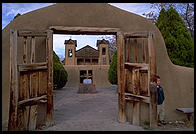
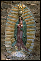 As far as Spanish adobe churches, the most famous
is in Ranchos de Taos, 90 minutes north of Santa Fe. The back of this church has
been done by every major Western photographer. The entire area from Santa Fe to
Taos is rich with interesting churches.
I really can't say that I've taken too many good photos of any New Mexican thing built by Anglos. There are a lot of huge adobe hotels and such in Santa Fe that are impressive for scale. Los Alamos National Lab is important historically. But I didn't spend enough time in the state to find good Anglo subjects.
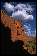
New Mexico has high snow-covered mountains, dry plateaus, pine forests, aspen forests, and canyons. There are also some animals but, unless you are especially fond of deer, these will be difficult to photograph.
I'll leave most of the cultural description to the official National Park Service site. Suffice it to say that Chaco is about a 4-hour drive from the ABQ airport, one hour of which is along a semi-rough dirt road (regular rental car is fine). Bring everything that you will need except water. Pitch a tent in the campground and feel envious of the people in their nice RVs.
Chaco was the center of a trading society with an extensive road network and far-flung settlements. There are all kinds of impressive ruins, notably Pueblo Bonito, which once contained 600 rooms and 75 kivas.
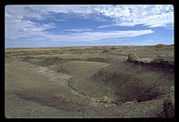 ... there are some interesting places to visit, not
least of which is Aztec Ruins National Monument. This area was built up by people
from Chaco around 1100 A.D. and then occupied by people from Mesa Verde around
1200 A.D. There is a ruined pueblo the size of a football field and a
reconstructed Great Kiva.
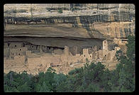 Strictly speaking, Mesa Verde is not in
New Mexico but rather just over the NW border into Colorado. However, it is
spiritually and physically quite close to Chaco and deserves to be included in
any tour of New Mexico.
Here's what I wrote to my brother back in 1994:
I'm very glad I got to Mesa Verde last weekend. The Park
Service is going to close all the ruins to tours in a couple of years, according
to one ranger. One could see why. They've instituted a ticket system for Cliff
Palance and Balcony House, two of the the largest ruins. The (free) tix sold out
at 11:30 and 1 on Saturday so I went only to Balcony House on Sunday (there is
plenty more to see in the park). About 50 people went on the tour and there was
really no way for them to all stay off the ruin walls. A really interesting
anthropologist gave the tour and explained the Anasazi movement from pit houses
on the mesa top (600 AD) to above-ground housing (1000 AD) to cliff housing (1200
AD) in terms of better food preservation technology to support a growing
population. (They bugged out entirely in around 1300 to become the Hopi and the
rest of the Pueblo Indians, presumably in response to a drought, deforestation,
and exhaustion of the local resources.)
... you might as well drive east from Mesa Verde until you get to Great Sand Dunes National Monument.
The most obvious photographic tip here is to plan your trip to include at least one sunset and at least one sunrise; the dunes aren't so interesting in the flat light of midday. There is a campground within the park and you'll be able to get plenty of rest because there isn't much nightlife inside Great Sand Dunes National Monument.
Try to avoid changing film out in the Dunes, especially if it is windy. Sand inside your camera will scratch the negatives and only hours and hours of painful work in PhotoShop will restore them. Sand can also get into lens focusing helicals so you might not want to take those $3,000 Hasselblad lenses out onto the Dunes if the wind is high.
The most interesting thing in Taos is the Pueblo.
[By the way, unless you are an expert skier, do not even think about skiing in Taos. It is one of the toughest mountains in the US and basically does not have beginner slopes. The nearby Angel Fire resort apparently caters to wimps to some extent, though I've never been there.]
Just a few miles south of Taos, this little town is world-famous for its church. Nobody seems to want to photograph the front of the church or the environs ...
Everyone wants to photograph the back of the church (which faces West). But I was there in March when it wasn't the right time of day for the light:
I returned in August and got better results:
Along the low (fast) road...
Chimayo, along the beautiful high road to Taos from Santa Fe, is famous for its church.
By law, structures in the center of Santa Fe must be built from adobe.
Art, however, can be built out of anything, including Cheese Doodles:
One weekend in August, Santa Fe goes crazy with "Indian Market", where hundreds of Native American artists converge on the plaza to sell their wares. How expensive are some of these? Suffice it to say that all of the cash machines in town are empty by Sunday afternoon.
Wherever I am, I like to take photos of dogs.
It would also seem that, wherever I am, I managed to get a photo of a Gay Parade, though Santa Fe's isn't as big as New York's.
Drive south from Santa Fe along the Turquoise Trail through Madrid, an officially charming artists' community. After you cross I-40, you'll eventually come to Salinas Pueblo National Monument, a collection of ruins. Here are my snapshots from the area:
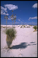 Fifteen miles southwest of
Alamogordo ("home of the Big One"), White Sands National Monument's pure gypsum
sands are presumably beautiful at sunrise. I wouldn't know because it was closed
when I got there at 7 am, the official opening time. The military was testing
missiles at the nearby White Sands Missile Range. By the time the monument opened
for tourists, it was too late to get any decent photos. To distract you from the
fact that I couldn't stay an extra day to cover the 275 square miles of dunes at
sunset and sunrise, I'll throw in some random facts. Uh... actually I can't think
of any random facts. You drive in 8 miles. You drive back out 8 miles. You get
out of the car sometimes to walk around a bit with your camera. You get back into
the car.
Oh well, here are some of my photos (taken around 10 am) just to let you know
what White Sands looks like:
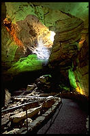 Deep in southern New Mexico,
Carlsbad Caverns National Park is impressively huge (one room is the size of 14
football fields). It is a tough place to photograph artistically. Electronic
flash will ruin the mood. The National Park Service is against lurid light shows
and mostly has the interior lit with subdued lights in just a few hues. Still, it
is worth a walk-through with a tripod. There is a cafeteria down at the bottom if
you should get hungry.
If you're going down as far south as Carlsbad, you should consider visiting Guadalupe Mountains National Park in Texas and Juarez, Mexico (across the border from El Paso).
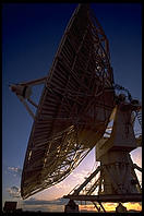 Officially in
Socorro, the Very Large Array is actually 50 miles west on a high deserted
plateau. Countless movie crews have been attracted to this spooky complex of huge
parabolic antennae on railroad tracks. There are 27 dishes, each 81 feet in
diameter. They can be spread out in a Y pattern 22 miles across. The basic idea
is that the VLA can work like an antenna that actually is 22 miles
across. The larger the antenna, the smaller angle over which it transmits or
receives. So the VLA dishes can be pulled in tight when radio astronomers want to
scan a broad area of the sky or spread out wide when investigating a small
region. Anyway, at this point I'm exhausting what I remember from freshman
physics at MIT, so you probably should check
the
National Radio Astronomy Observatory server for more info.
On your way back from the VLA to the Albuquerque airport, consider stopping at the Acoma Pueblo, continuously occupied since 600 A.D.
The only thing that I can really recommend in ABQ is the National Atomic Museum
 You might find
this map helpful.
The New Mexico Handbook (Stephen Metzger; Moon) is my favorite guidebook to the state.
Most of these images were taken in March of 1994 with a Nikon system (F4, 24, 50/1.8, 105 macro, 80-200/2.8) or in the summer of 1994 with a Canon EOS system (14, 20-35/2.8L, 50/1.0, 35-350L). Film was either Fuji Velvia, Fuji Sensia. In almost all cases, a tripod was employed. The exceptions are some pictures taken with a Yashica T4 point & shoot camera and Fuji ISO 400 color negative film. In all cases, the images were scanned to Kodak PhotoCD and then run through the batch conversion tools that I give away in my image library presentation tutorial.
Text and photos copyright 1994-1997 Philip Greenspun