
by Philip Greenspun; created 1993-1996
Home : Travel : Great Trips : Holes in the Ground
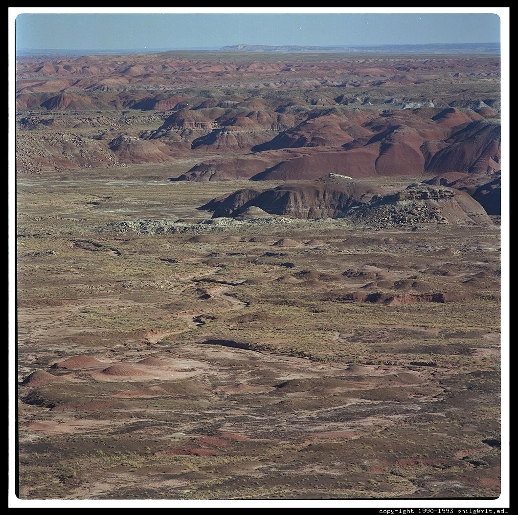
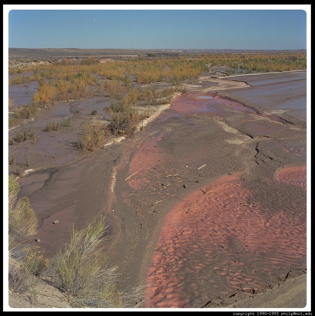
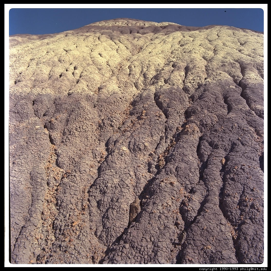
Start your trip in Flagstaff, Arizona. Head east to the Petrified Forest National Park, which also affords fine views of the Painted Desert.
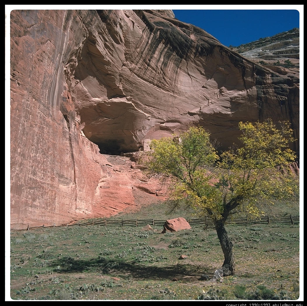
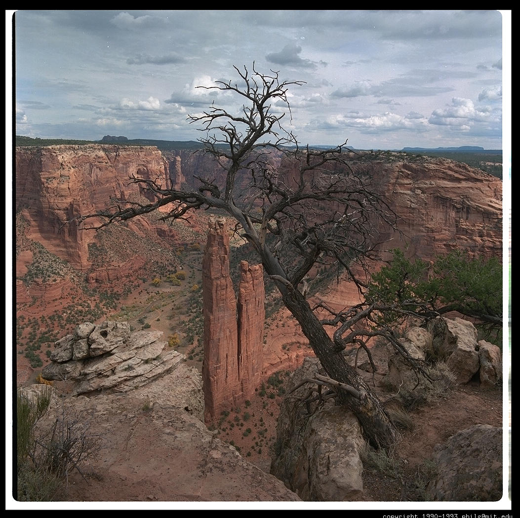
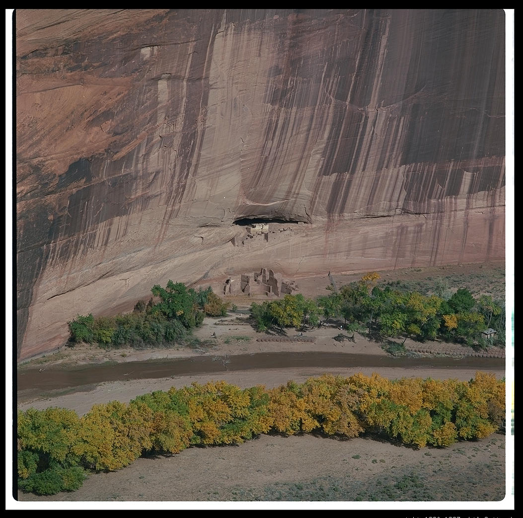
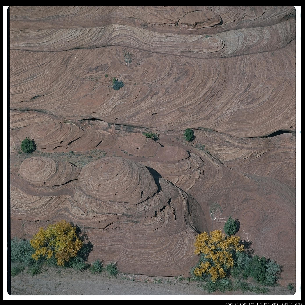
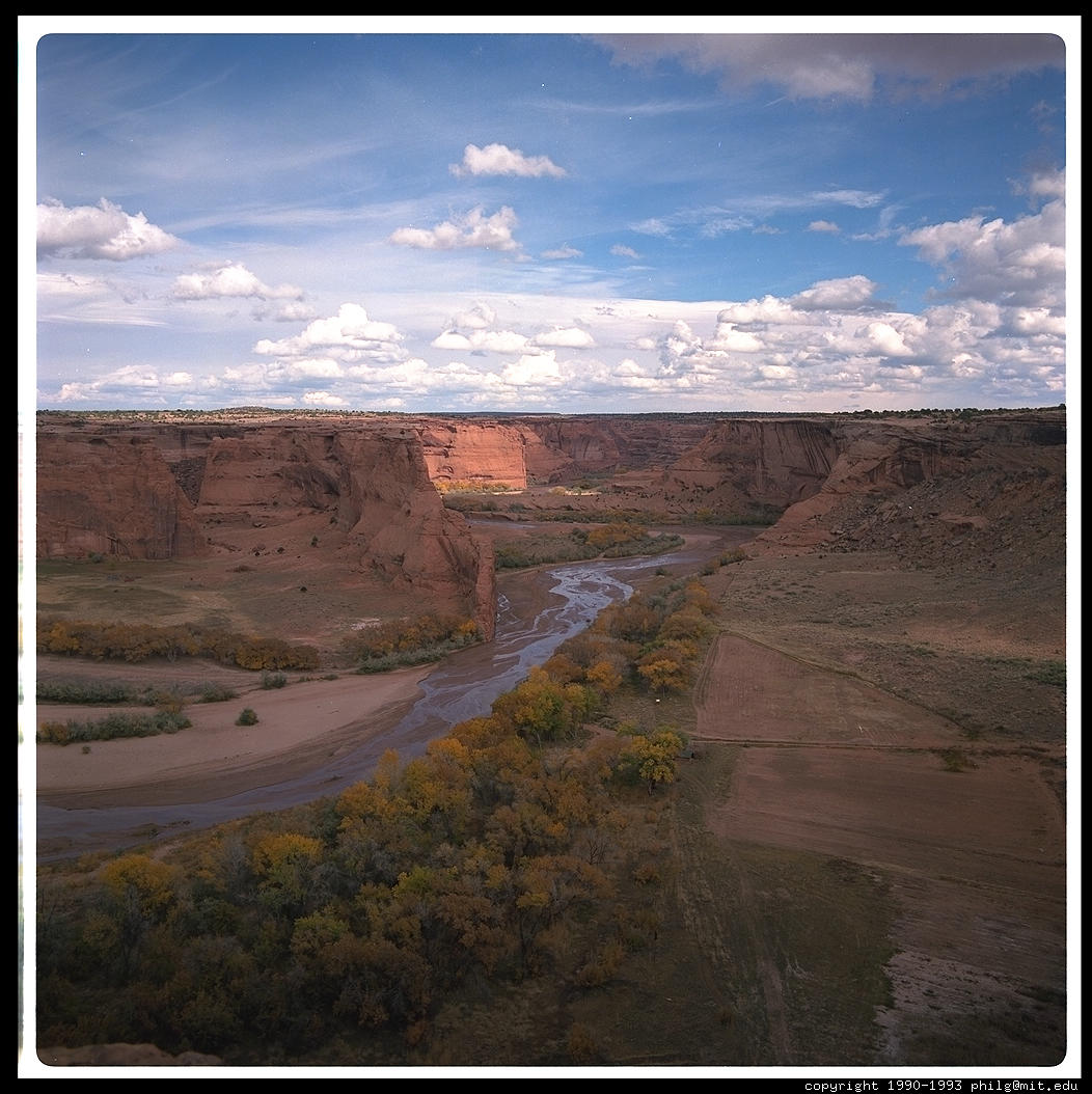
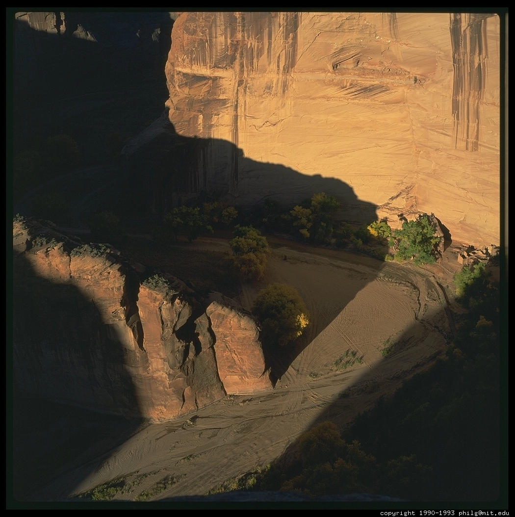
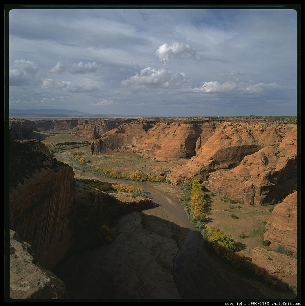
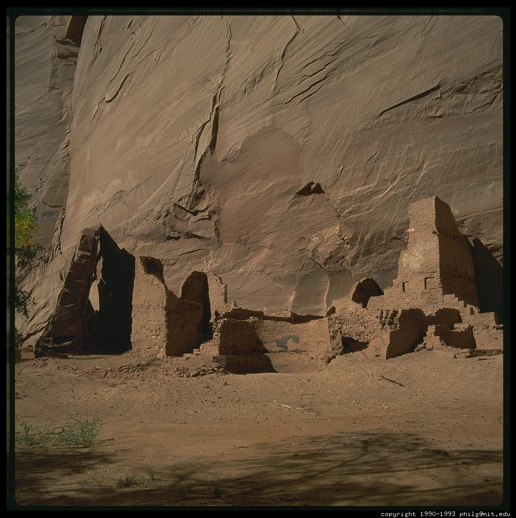
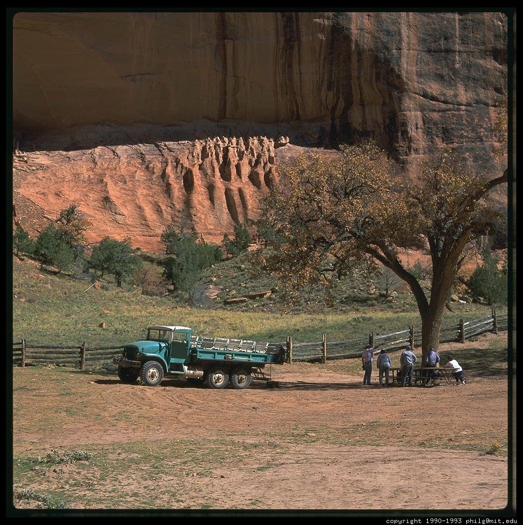
 Go north on US 191 through the Navajo Nation to Canyon de Chelly
National Monument. The Navajo run their national parks a bit differently than the
Federales. For one thing, they continue to use the land as they have been since
the 16th century. If someone was once farming or herding in what is now a park,
their grandchildren are still farming or herding the same land. Consequently,
you'll need to hire a guide if you want to see all the Anasazi ruins and
pictographs in the twin 25-mile long canyons. It isn't a bad way to learn
something about the Navajo way of life.
Go north on US 191 through the Navajo Nation to Canyon de Chelly
National Monument. The Navajo run their national parks a bit differently than the
Federales. For one thing, they continue to use the land as they have been since
the 16th century. If someone was once farming or herding in what is now a park,
their grandchildren are still farming or herding the same land. Consequently,
you'll need to hire a guide if you want to see all the Anasazi ruins and
pictographs in the twin 25-mile long canyons. It isn't a bad way to learn
something about the Navajo way of life.


Monument Valley is another Navajo-run park, two hours through beautiful desert northwest of Canyon de Chelly. A dirt road, sometimes crowded with sheep herds, leads through the bluffs. Hire a guide and get off the beaten track.
Continue north out of Monument Valley to Mexican Hat, just outside the Navajo Nation. You'll know that you've reached U.S. soil again when you see bars and liquor stores; the reservation is dry. Turn left on SR 261 into the Valley of the Gods and then climb straight up a mesa edge with no guard rail. I felt pretty macho driving up this road until I met a guy coming down towing a huge boat. Turn right on SR 95 and then up US 191 for a couple of hours to Moab, where Mormon farmers meet mountain-biking espresso-sipping yuppies.
Moab is a good place to stop for a week. The bike rack in front of Kaibab Bike is a lot like the valet parking stand of the Beverly Hills Hotel: Lycra-clad drivers drop off the world's most expensive custom-made machines plus a bunch of absurdly-expensive mass-produced ones. At Kaibab, however, all the machines are American and most are badly dented and scratched. When I was there in 1993, Clark, the shop's assistant manager and some visitors were chatting about how lonely life here can be for a single guy in this town of 6,000. "I've ridden here every day for four years and can count on the fingers of one hand the number of single women I've seen on the trail."
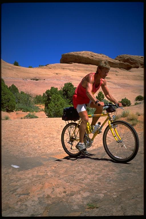 Despite the
lack of women, the Slickrock trail is justifiably America's most famous ride.
Slickrock winds through a landscape of fantastic beauty: red sandstone sculpted
into towers, canyons, squatting lumps, and the Colorado River flowing through it
all. Scrubby trees soften one's immediate environment and the 12,000' La Sal
Mountains covered with trees and/or snow provide a pleasant backdrop.
Despite the
lack of women, the Slickrock trail is justifiably America's most famous ride.
Slickrock winds through a landscape of fantastic beauty: red sandstone sculpted
into towers, canyons, squatting lumps, and the Colorado River flowing through it
all. Scrubby trees soften one's immediate environment and the 12,000' La Sal
Mountains covered with trees and/or snow provide a pleasant backdrop.
 Here is a
typical sequence of the Slickrock. Step One: survey the landscape from the top of
a 40'-high lump. Step Two: Bike straight down the 30-degree side into a pit about
the width of your bike tire. You've two choices here: don't brake or brake. If
you don't brake, you'll crash into the pit at 35 mph. If you brake, little bumps
on the way down will hurl you over the handlebars at 15 mph. Whatever you choose,
remember to get off the brakes and adjust your weight so that your bike doesn't
get stuck in the pit and send you flying over the handlebars and into the next
rock. Step Three: start up the next 40' lump. The 30-degree slope will have you
standing on your pedals in the lowest of your 21 gears. Remember to keep your
weight forward or you will lift the front wheel and fall off the back of the
bike. Step Four: get to the top exhausted from the heat, climb, and thinnish air
at 4500'. Step Five: drink from your dwindling water supply; go to Step One.
Here is a
typical sequence of the Slickrock. Step One: survey the landscape from the top of
a 40'-high lump. Step Two: Bike straight down the 30-degree side into a pit about
the width of your bike tire. You've two choices here: don't brake or brake. If
you don't brake, you'll crash into the pit at 35 mph. If you brake, little bumps
on the way down will hurl you over the handlebars at 15 mph. Whatever you choose,
remember to get off the brakes and adjust your weight so that your bike doesn't
get stuck in the pit and send you flying over the handlebars and into the next
rock. Step Three: start up the next 40' lump. The 30-degree slope will have you
standing on your pedals in the lowest of your 21 gears. Remember to keep your
weight forward or you will lift the front wheel and fall off the back of the
bike. Step Four: get to the top exhausted from the heat, climb, and thinnish air
at 4500'. Step Five: drink from your dwindling water supply; go to Step One.
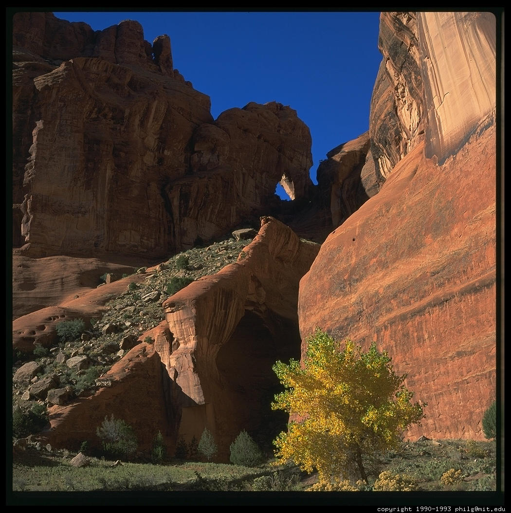
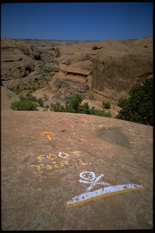
In the heat of the summer, the 2.5 mile "practice loop" might be more than enough, but if you feel adventurous, the 14-mile Slickrock segues into the Kokopelli Trail (140 miles; no water). Adjacent Canyonlands National Park contains the White Rim Trail, an old jeep road that is open to 4WD vehicles and mountain bikers willing to invest 4 or 5 days. Tour companies run vehicle-supported trips over both trails. Don't forget to visit Arches National Park.
I've never figured out what is so great about Capitol Reef National Park, but it is on the way to Bryce Canyon so you might as well stop there. From Moab, go back to Blanding on US 191 and west on SR 95 which crosses Lake Powell before moving into the sandstone formations of Capitol Reef. My favorite part of the park is Utah SR 12 at the west end and it would be a shame if you only spent three hours on it before stopping at Bryce, my favorite canyon.
The Grand Canyon is a mile-deep hole in the ground. Bryce is only a 500'-deep hole in the ground, but it is filled up with red and white sandstone spikes. When you hike to the bottom of the Grand Canyon (see below), the scenery changes imperceptibly because everything is so big and far away. Hiking through Bryce, there is a new delight every few minutes.
Zion National Park is three hours southwest of Bryce. The most impressive thing about Zion is little handholds hacked into a sheer 3000' rock face. The Indians thought the place was inhabited by evil spirits and would climb out of the canyon every night. Another great thing about Zion is that the park service paved the popular Narrows Trail so that the wheelchair-bound could get into the north end of the canyon, 1000' deep but only 20' wide.
At this point you are close to the not-very-touristed North Rim of the Grand Canyon and you might think that you should head straight south. However, the North Rim is much farther from the Colorado River than the South Rim so you cannot possibly hike down and up the same day. If you do go to the North Rim, make sure that you stop in Colorado City, Arizona, the home of a rogue sect of Mormons who don't hold with the 1898 ban on polygamy. Otherwise, head back east to Page and Lake Powell.
John Wesley Powell surveyed the Colorado River for the U.S. Government in the 1870s. He wrote that Glen Canyon was much more beautiful than the Grand Canyon. Although the Colorado was already dammed above and below Glen Canyon, the Feds started work on Glen Canyon Dam in 1956. The resulting reservoir stretches back 186 miles, filling in all of Glen Canyon with sediment that will persist once the dam is gone. As a tribute to Powell, they named the reservoir that destroyed the canyon he loved "Lake Powell."

Despite the despoilation of Glen Canyon, Lake Powell is beautiful in its own right. Cold blue water shimmers against red sandstone formations. You will easily understand why Arizona has the nation's highest per capita rate of boat ownership.
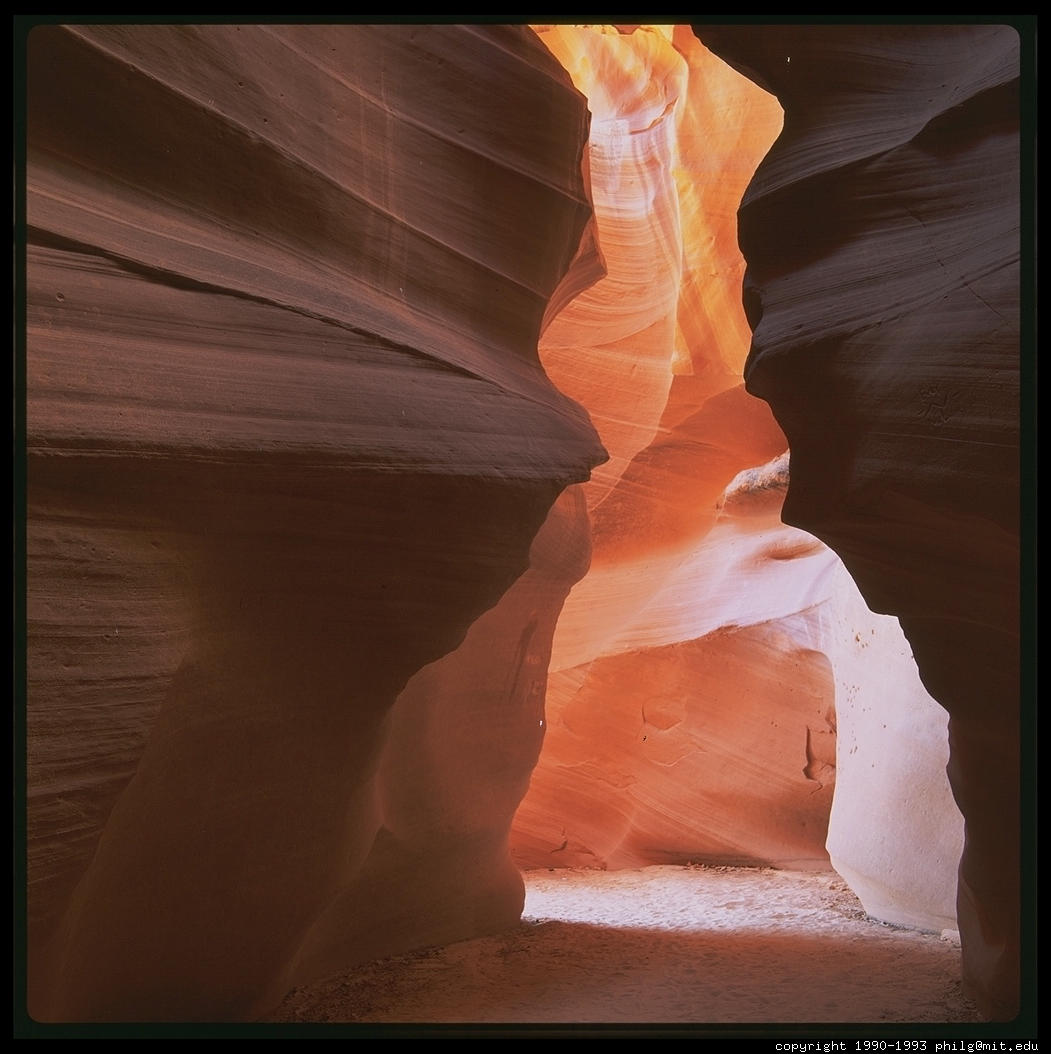
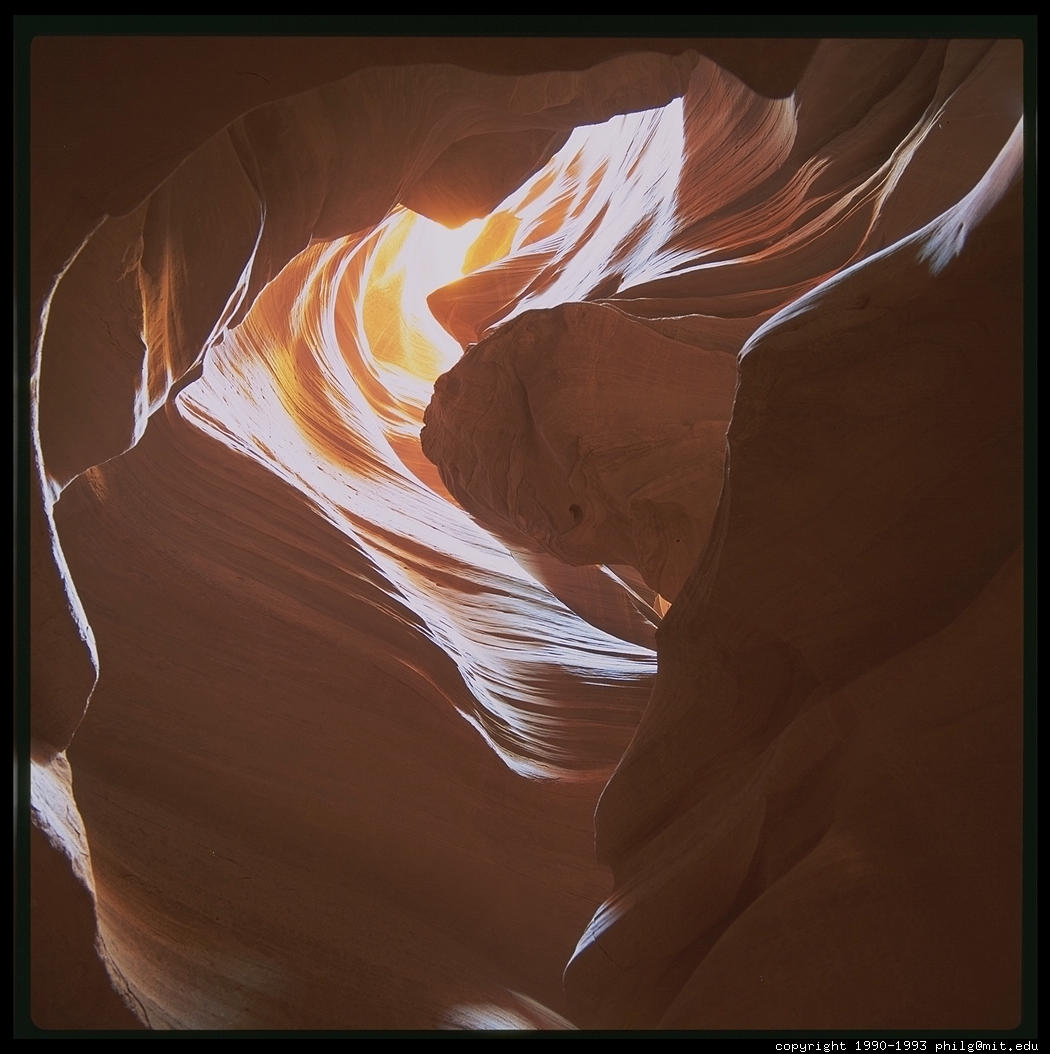
The area around Page is slot canyon country. Slot canyons are deep narrow cuts in sandstone plateaus. All of the sunlight that reaches the bottom has bounced many times off the sandstone walls, each time becoming more red. The Corkscrew is the most easily reached from Page, just a few miles southeast of town on Navajo land. You'll need to hire a Jeep taxi to get down a sandy wash to the canyon.
You're only three hours from the South Rim of the Grand Canyon at this point and it is on your way back to Flagstaff, so you have to go. The Grand Canyon is anticlimactic for most people. It is so familiar from magazines, books, and movies and the real thing looks just like the images you've seen. Still, it is worth the trip even if you are one of the 98% of park visitors who never ventures more than 50 feet below the rim.
Although the rangers will discourage you from even thinking about it, it is quite easy to hike down and up in the same day. I did it on a July day when the temperature at the river was 118. Here's the drill. One: pre-hydrate by drinking lots of water the night before. Two: start hiking down the Kaibab Trail no later than 6 am. The Kaibab is a "ridge trail" and consequently offers spectacular views for all 7 miles down to the river. Three: you will probably arrive at Phantom Ranch around 9 am. Buy a lemonade, tuna sandwich, call your mother from the pay phone, and watch the people who reserved a year in advance get ready to mount their mules. Four: fill up your canteens with water and walk two miles along the Colorado River to the Bright Angel Trail. Five: walk 8 miles up the Bright Angel Trail back to the rim. The Bright Angel Trail is a "stream trail" so you don't get much in the way of views, but you will be shaded and the Park Service runs a water pipe down the Bright Angel so you can refill your canteens every couple of miles. You'll be back on the rim around 8 pm if you take it very leisurely. Unlike the people who rode the mules, you won't be walking funny for a week afterwards.
It is about a two hour scenic drive back through Flagstaff and into Sedona, the last stop on this tour. Most people come here to shop and drive through Oak Creek Canyon, but I think you have to hike up the West Fork to really experience the place.
If you are actually planning to take this trip, you may wish to look at the user-contributed Related Links page.
Return
to the Great Trips index page
Text and pictures copyright 1993-1996 Philip Greenspun