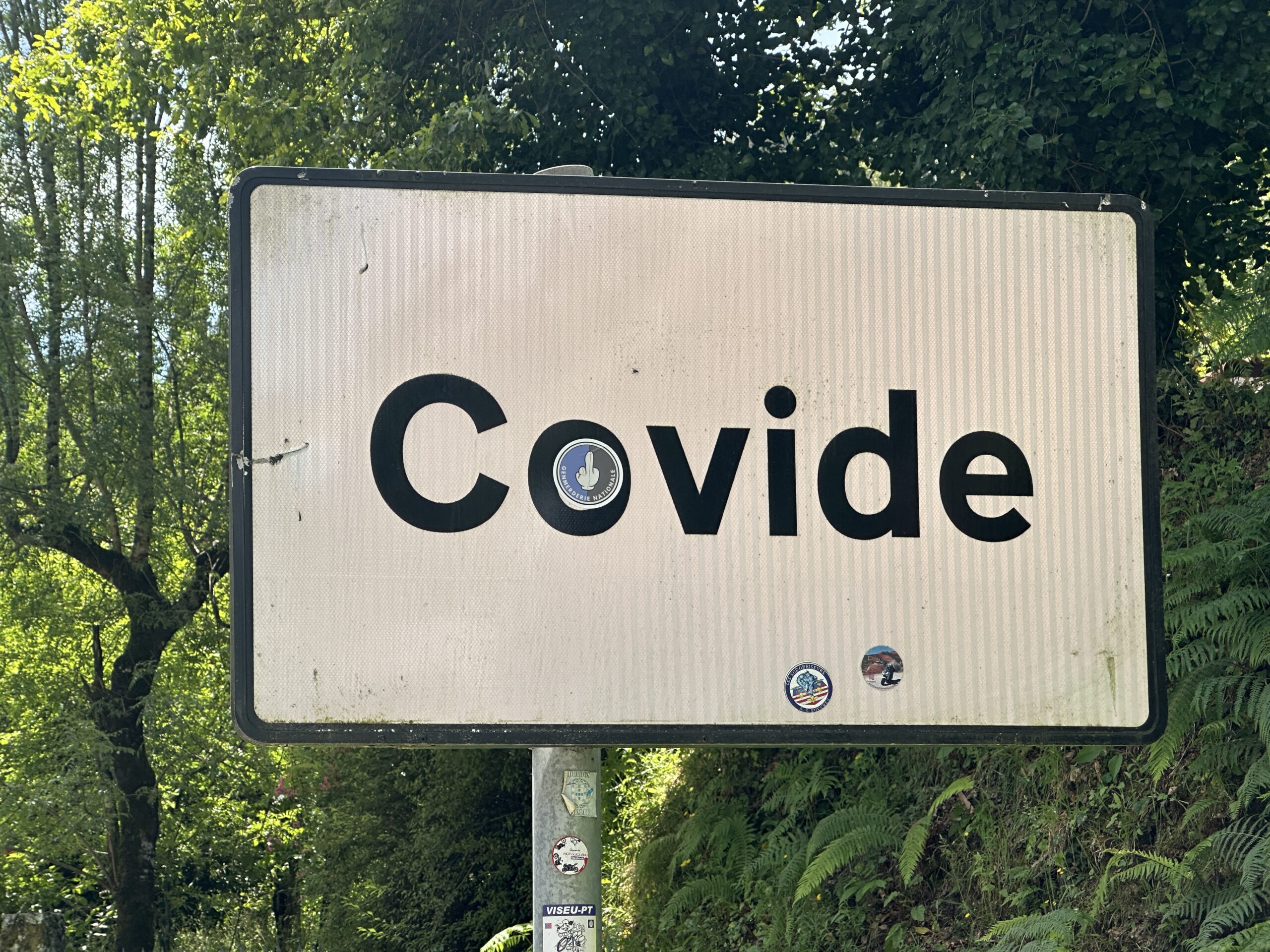
We used Google Maps in Portugal. It made quite a few absurdly bad routing decisions. To save a theoretical minute or two it would send our Mercedes E class sedan down roads narrower than a North Carolina dentist’s driveway. We were constantly terrified that a car would appear coming the opposite direction and that we’d be forced to stop suddenly and then back up to a rare section wide enough for two cars to pass. When shown these routes, the locals said that they would never drive along those roads for transportation despite most of them having narrower cars and better driving skills than a Floridian lulled into complacency by textbook highway engineering. Below is a segment from a suggested Google Maps route for our rental car (#2 after the first E class melted down). I don’t think that our Sixt rental agreement says anything about driving up or down stairs, but the road was definitely narrower than the car:

Where was this road, you might ask? In one of my favorite towns in Portugal: Covide!
Is there a mapping app that is smarter about getting around Europe without scraping?
Related question for the U.S.: is there an app that will calculate walking directions to avoid dangerous neighborhoods? Or calculate directions and score the walk with a danger level? This tweet from a former Googler suggests that Google will never do it:
(His/her/zir/their reasoning is that sending pedestrians via a scenic route will lead to “spatial inequality” because the nicer areas tend to be richer.)
WalkSafe seems to have the crime rate information, but I’m not sure that it will provide turn-by-turn directions to a pedestrian.
Here’s a street in front of an AirBnB that we rented in Amarante, Portugal (very pleasant town!):

(The host said to navigate to a nearby parking lot and walk the rest of the way.)
I don’t have a good illustration of a crime-ridden street in Portugal because the country is one of the safest in the world and every tourist attraction seems to be in a safe area.
The algorithmic racial bias people will not permit a mapping/directions app to incorporate crime data. “No-go” areas are always secret, lest they appear to show the wrong impressions
Non-app solution.
Garmin Camper (Satnav hardware) with Portugal and Northwest Spain Charts, BlueChart g3 HXEU009R is a very expensive solution that would work. It pays to slightly exaggerate car sizes.
Satnavs may be added to car hires but they probably don’t have vehicle dimensions feature.
Google Maps is pretty bad in Europe.
Use https://www.tomtom.com/en_us/navigation/mobile-apps/go-navigation-app/ and set it to Truck mode.
“Enter the dimensions of your vehicle and cargo type to get customized route guidance” refers to what you want.
Pretty sure it’s intended more to extract value from your location history than provide value to you. Goog bought the path finding software & just let the founders vest in peace. They did add a lot of popups however.
You may need to use paper maps.
I never used Waze in Europe, but by its architecture it should have inputs from other co-traveler Wazers. Waze driving directions are so much better then Google’s
Seems common sense is not very common in the Greenspun vehicle. But then again, gpsfails wouldn’t exist without technology reliant geniuses such as yourself. Also, please consider not returning to Europe (anywhere).
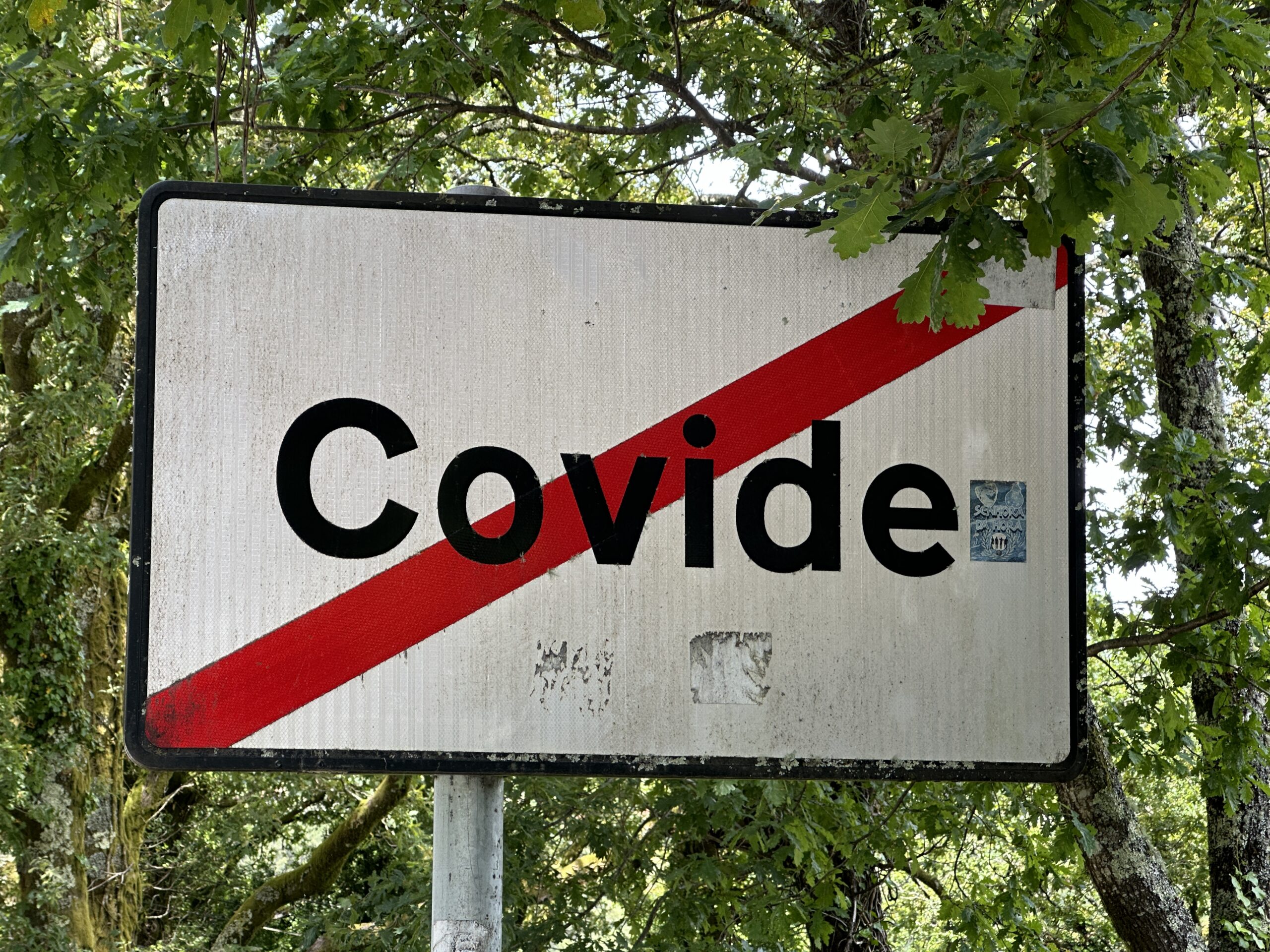
This blog is one of the last places I expected to see a photo of Covide, where my parents still live. It is a little disingenuous to show that photo of the path to the Church, since it is requires multiple flights of stairs and it is quite obvious a car would never get there. But I get your point, there are many places in the north of Portugal with extremely steep or narrow streets where you’re never really sure if you can get the car out.
The challenge for GPS apps is whether or not the data exists. It is probably not mapped well within public databases, so maybe community services like Waze are the only way. Using a GPS in northern Portugal can be asking for trouble. Sometimes it will try to save 100m by going through some smaller street, which you should never do, because unless you are a local, it is never guaranteed that a car can actually go across. Even in Porto or Lisbon it is not that difficult to find streets so narrow that you have to pull in both side mirrors to make it through.
I have driven a Tesla in Covide (yes, it is possible) and once near Terras de Bouro took a wrong turn to an incredibly steep small street that was probably only meant for ox carts. It was quite stressful having to reverse into the busy highway with almost no visibility.
Some comments on the other posts. Barragem Vilarinho das Furnas: at some point this was a busy two-way road and the main thoroughfare in the region. Very often was tricky to cross on foot because it was packed with cars. Then some people would park the car on the dam and cause havoc, so for a period there were boom gates and traffic was restricted to service vehicles. But I guess now most inhabitants have either died or moved away that the traffic is so low that no one cares about allowing it through. Even with a large truck bomb you’d only damage a hydro plant superficially (see how the Russians blew up Nova Kakhovka dam). If the US dams restricted traffic to only cars, it would be enough to mitigate any serious risk.
About driving electric cars in Portugal and across Europe. I have driven a Tesla from Portugal to Scandinavia and back with no problems. Biggest shortage of chargers was in Spain and Portugal, actually. France and Germany have so many superchargers that you never need to worry. Most EU superchargers are open to any car, not just Tesla, although sometimes it is a bit weird to park if the charging socket is on the right side of the car. But there are only about three Tesla superchargers in Portugal, so you need to use other chargers. The national charging grid initiative is pathetically bureaucratic and nearly impossible to use by non-residents, which is really a shame. But some companies (e.g. Miio) you can charge via their app, which needs only a credit card (although with some stupid pre-payment). The best option is to use an all like Plugsurfing, which gives you access to most chargers and you can use a credit card. In Portugal, many Lidl shops have a fast charger and those you can use Plugsurfing to charge. The only countries where I saw fast chargers that accepted a credit card in the machine without some app or preregistration were Switzerland and Denmark. But things are changing. In Norway, since a few years ago all new chargers installed must support credit cards.
If you visit Gerês again, you can stay at Parque de Campismo de Cerdeira; I hear they just installed a Tesla destination charger there. And the restaurant is really good!
João: Thanks for all of the travel ideas! I think this is a great part of Portugal, though I wish that one could do simple errands, such as a supermarket run, without driving on twisty narrow-by-US-standards roads. It’s a lot easier to get around Florida whether by foot, bike, or car, due to the flat terrain and wide roads/sidewalks!
(I showed the photo of what Google Maps thought was a “road” because that was part of our Google Maps route during our trip to Covide. Given the stairs, it was definitely Google’s worst idea over a 12-day period, but there were plenty more bad ideas!)
The Barragem Vilarinho das Furna road was very quiet when we were there. Maybe one car every 10 minutes. The U.S. passion for dam security makes sense, I guess, because of our asylum-based immigration system (people come here not because they like anything about the U.S. but because they say that they were on track to be killed where they used to live). But, on the other hand, if we are interested in security why don’t we end asylum-based immigration and prevent people from walking across the southern border? Here’s an example of one of our new neighbors:
“An Afghan migrant on the terrorist watchlist spent nearly a year inside the U.S. after he was apprehended and released by Border Patrol agents last year, … Border agents suspected [Mohammad Kharwin] was on the U.S. terrorist watchlist when he was apprehended because one piece of information matched a person on the list. But the agents lacked corroborating information, which officials declined to describe, that would confirm Kharwin was the person they suspected, U.S. officials said.
After it processed Kharwin and took his biometric data, Customs and Border Protection released him as it would any other migrant, without alerting Immigration and Customs Enforcement about possible terrorism ties, U.S. officials said.
Kharwin was referred to ICE’s Alternatives to Detention Program, requiring him to check in periodically by phone with an ICE officer. He was able to apply for asylum and work authorization and fly domestically in the U.S., the officials said.
… he is a member of Hezb-e-Islami, or HIG, a political and paramilitary organization that the U.S. has designated a terrorist organization. According to the national intelligence director’s office, HIG is a “virulently anti-Western insurgent group” that sought to overturn the Western-backed Afghan government before its fall in 2021.”
https://www.nbcnews.com/investigations/man-terror-watchlist-remains-us-released-border-patrol-rcna147192
This is not to say that I think Mohammad Kharwin isn’t enriching the U.S. via his arrival here at age 48 (he’ll reach full Social Security retirement age around the same time that he has learned to speak English reasonably well?), only that Mr. Kharwin and any children he may have might not agree with official U.S. values, such as worshipping the sacred Rainbow Flag. (see https://en.wikipedia.org/wiki/Omar_Mateen for an example of a child of Afghan migrants who never accepted the U.S. state religion)
Apple Maps does this in Japan. I finally learned my lesson and now stick to the stock Nissan system in the car.
You need to stick to the major roads (2 or 4 lanes, as opposed to 1 to 1.5 lanes, which curve all over that place) until the final approach to your destination.
I think part of the reason for the differences in the systems is that the Japanese guys are more sensitive to pissing off residents of small, sidewalk-less streets, full of kids walking to school, etc. Apple’s tech guys just go with theoretical speed, without knowing that the streets are only really navigable to locals.
“(The host said to navigate to a nearby parking lot and walk the rest of the way.)”
What, like animals?
I’ve had this exact problem in Europe – especially Scotland. In England’s Lake District I asked Google to take me to the Castlerigg stone circle (a mini-Stonehenge) and it took me up a mile long single lane with stone walls on both sides, and nowhere to pass. Thankfully I did not meet another car. It can be nerve-wracking.
OpenStreetmap and OsmAnd (f-droid) may or not already contain the road width info, but if not, it lets you scratch that itch by editing maps based on local knowledge. Offline maps without traffic/tracking FTW!