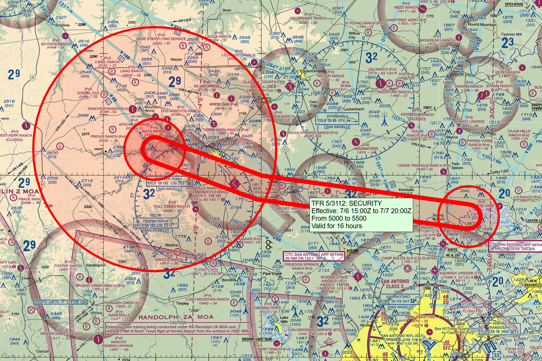
Here’s the FAA visual flying chart for the area northwest of San Antonio, overlaid with temporary flight restrictions (TFRs) by skyvector.com. Based on the TFRs, it looks as though the base for air operations in the search and rescue is the Kerrville Municipal Airport (KERV), a jet-capable general aviation airport with a flight school and FBO, but no control tower (a common traffic advisory frequency of 122.7 is advertised for pilots to talk to each other). It seems as though there are two main search and rescue areas, one just to the west of the airport and one to the east.
“Terrified Girls, Helicopters and a Harrowing Scene: A Rescuer’s Account at Camp Mystic” (New York Times):
Scott Ruskan, a 26-year-old Coast Guard rescue swimmer based in Corpus Christi, Texas, woke up to banging on his door in the early hours of July 4. There was flooding around San Antonio and he was being deployed, he was told. … Mr. Ruskan and his team took off on a helicopter around 7 a.m. Central on Friday to the camp, near Hunt, Texas. It took them nearly six hours to reach San Antonio because of poor visibility and challenging weather conditions. “A white-knuckle experience,” he said.
It’s only 166 nautical miles from KNGP to KERV so the trip should have been doable in just over an hour with decent weather. (The NYT doesn’t name or credit the pilots.)
That must have taken a lot of refuelings. Just drive the gas truck.