Artemis II launch experience
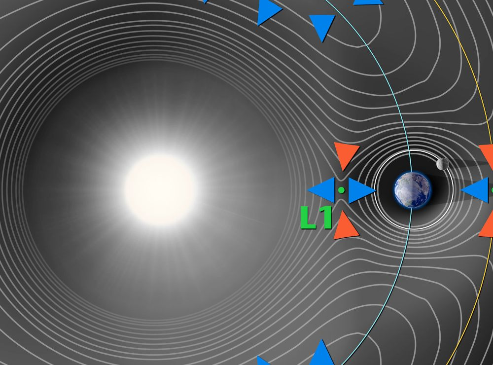
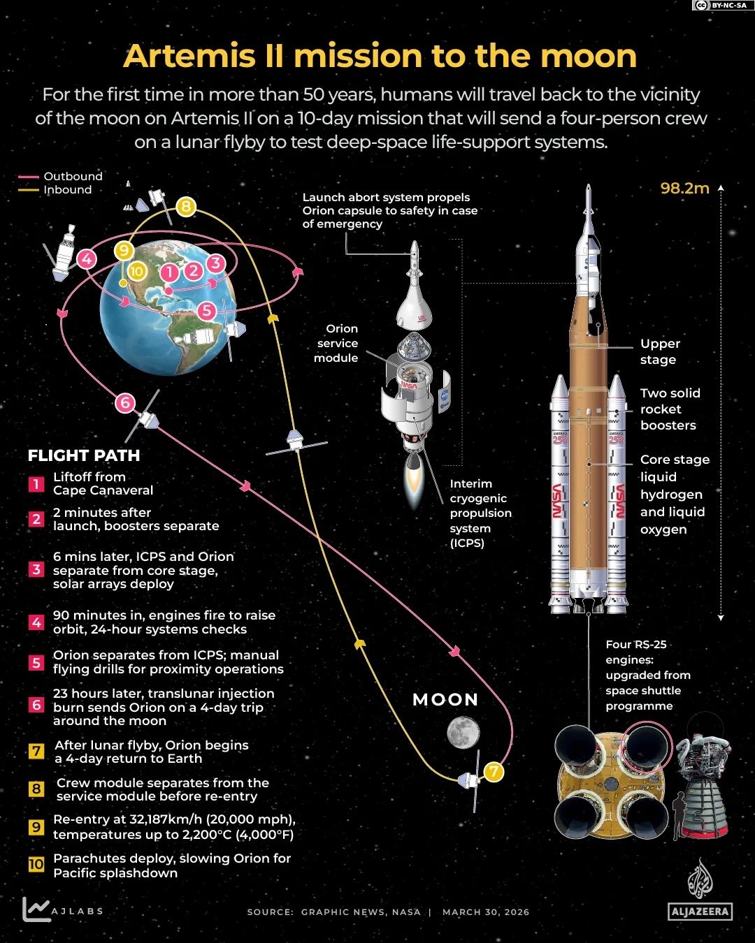
I went to the Kennedy Space Center Visitor Complex yesterday to watch at least $2.5 billion of our tax dollars getting incinerated via the Artemis II mission. The best graphic that I’ve found to explain this somehow comes from Al-Jazeera:
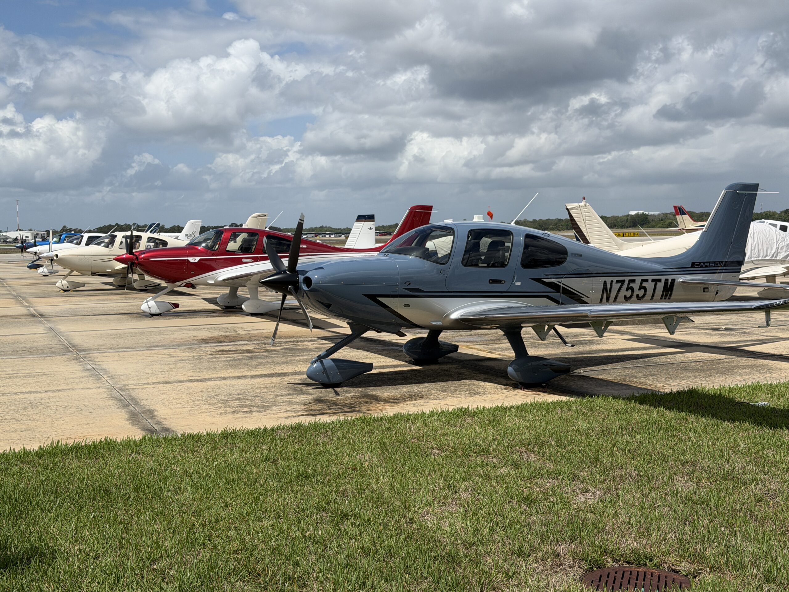
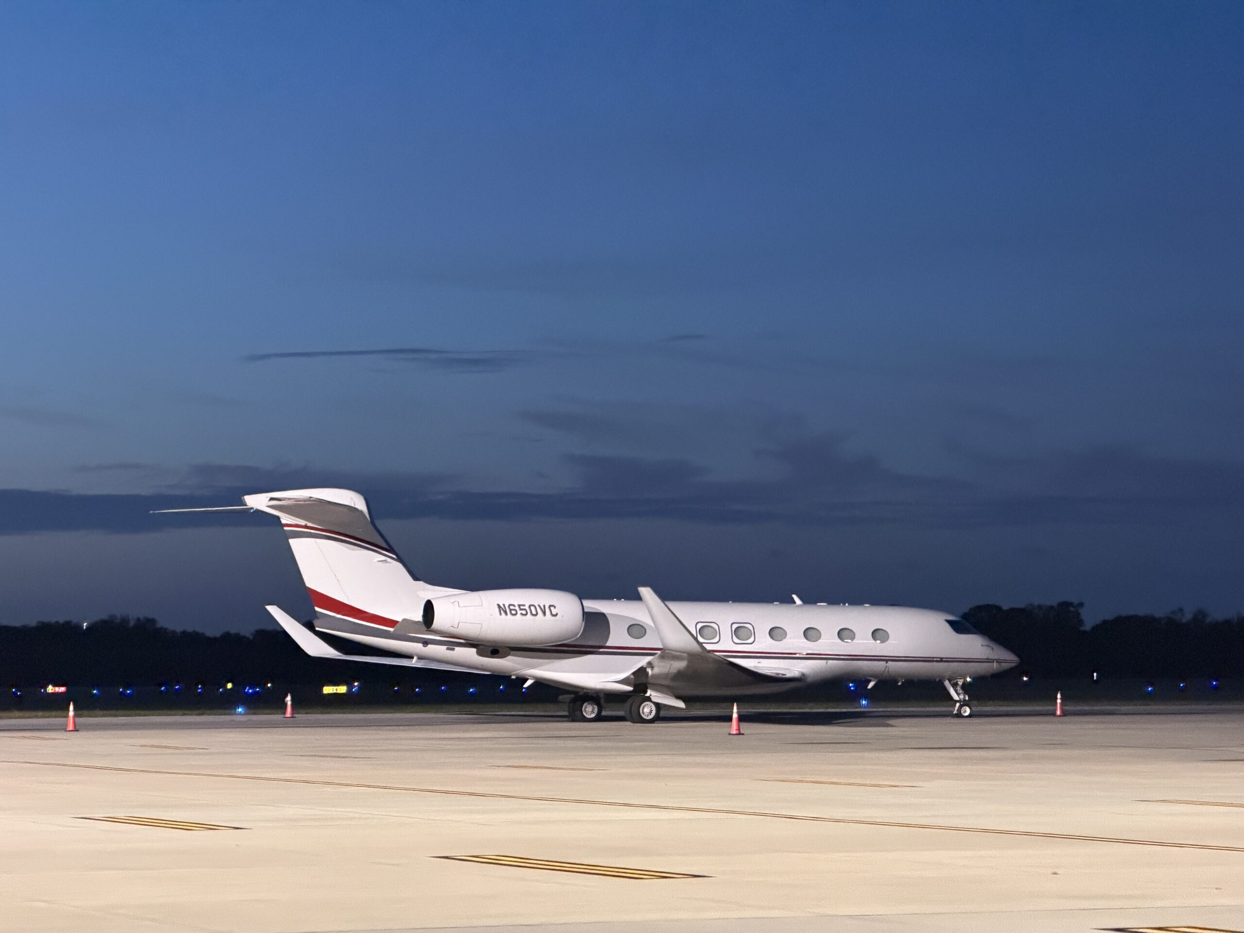
My journey began with a flight (2005 Cirrus SR20 with no A/C) from our South Florida redoubt to KTIX. The sole FBO was slammed so they established a piston ghetto parking area on the east side of the field and deputized flight school employees to park the planes that weren’t worth dealing with. Here’s the Cirrus row:
I arrived around noon and my Enterprise rental car wasn’t there. “They had to deliver 300 cars to NASA,” explained the FBO gal. Eventually a 19-year-old flight instructor gave me and two other Cirrus pilots rides to the downtown Titusville Enterprise office. The 19-year-old had gone straight from high school to flight school and, now in possession of all her ratings, was working as a CFI rather than paying $400,000 to listen to PhD mediocrities (being a Florida, she could presumably have gone to college essentially for free via Bright Futures, but her flying career would have been delayed by four years; she can get an online bachelor’s degree if she ever needs one). I then stopped at Publix to pick up sandwiches and returned to the airport to pick up a friend in his ghetto-adjacent Piper Malibu JetPROP. My friend, an AI-coding entrepreneur, had found unauthorized resale tickets on Reddit for Kennedy Space Center viewing at $155 each ($99 face value; to have gotten our own tickets we would have had to notice an email sent from the KSC that Gmail maps into Promotions and then purchased the $99 or the $250 “feel the heat” ticket within the first few seconds (“feel the heat” is viewing from the Saturn V building, just 4 miles from the pad; the main KSC has a much larger capacity and is 8 miles away)). He brought along a guy who has some connection to a commercial space company. Let’s call him “Space Friend”. At the “real FBO” we met a father-daughter pair who’d just stepped out of their personal Challenger (“I work in finance” said the dad, when Space Friend asked). They had arranged a car service to take them to a public park, but Friend had two extra tickets so we invited them to jump into the Enterprise minivan with us and go to the KSC.
[AI for Cool Kids Tip: Claude Code for initial development. Codex for finding bugs.]
Combining the delays of getting the Enterprise car, Space Friend fighting through Miami traffic to reach KFXE, and Friend+Space Friend having to sit on the ground at KFXE waiting their turn to take off (45 minutes due to heavy flight school volume), we ended up on the road at about 3:15 pm, a mistake of monumental proportions. There was a security check to get onto the NASA Causeway and we were also asked if we had tickets, but didn’t have to show them. Somehow this caused an epic traffic jam despite the fact that the security check for us took about 15 seconds (everyone trusts minivan owners!). We arrived at the Kennedy Space Center Visitor complex around 5:30 pm (i.e., 2+ hours for what is normally a 15-minute drive). The parking lot attendant asked us to show a phone screen of our ticket, but didn’t scan it. There were some people watching the launch from the parking lot (pretty much the same view/sound as inside) so I wondered if they had pictures of someone else’s ticket or perhaps they had the $99 tickets and didn’t like crowds.
It’s a shame that we didn’t bring Mindy the Crippler because we were greeted by a bunny near the entrance:
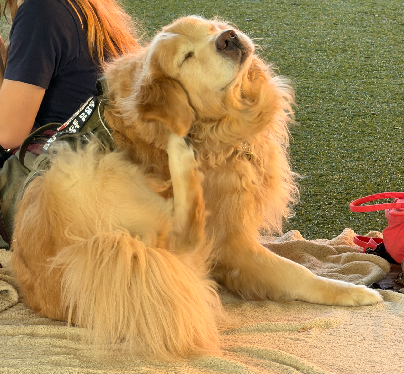
Our sketchy Reddit tickets actually did scan, so we were able to enter and find a golden retriever:
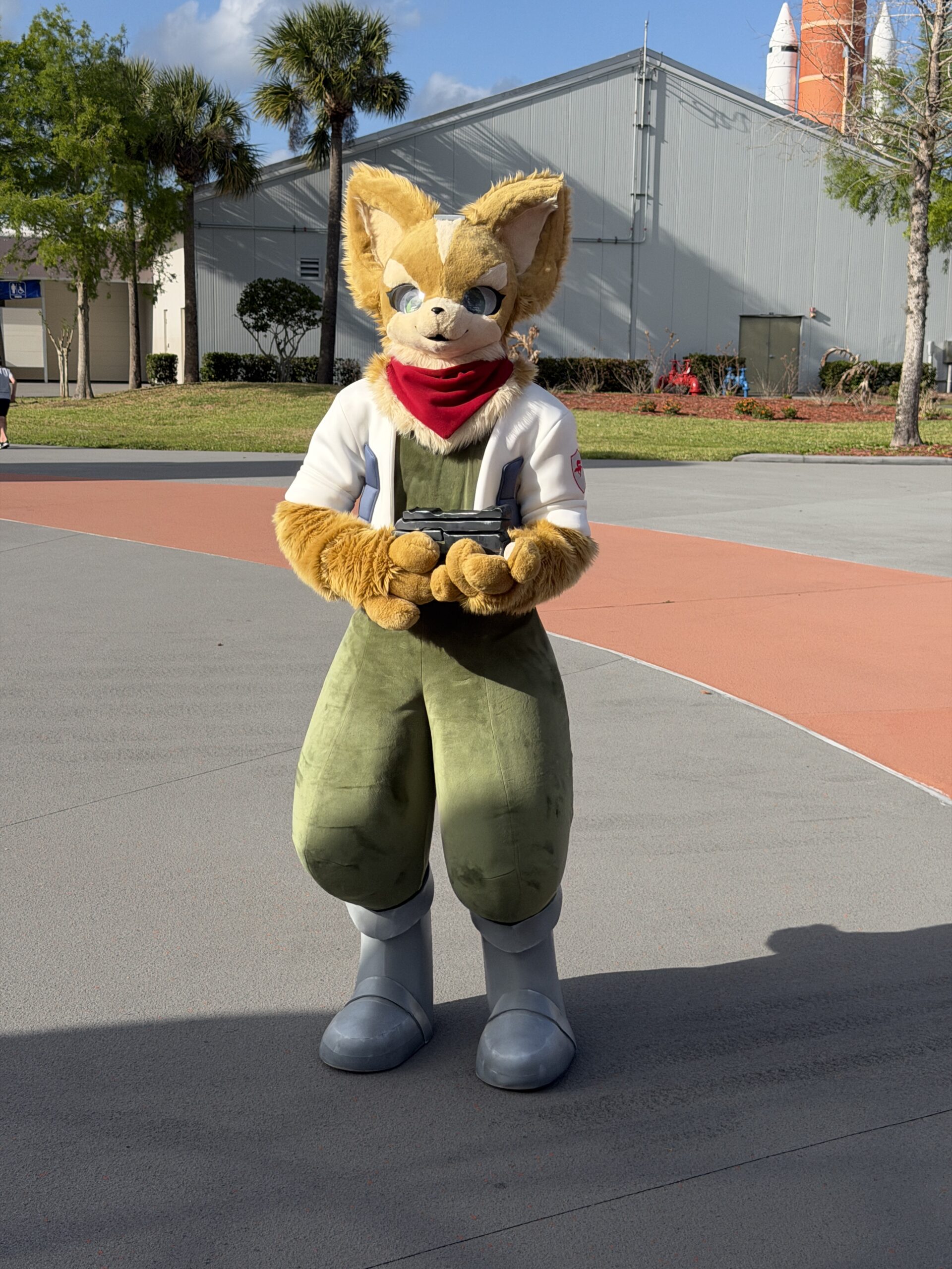
Also the Artemis backup team:
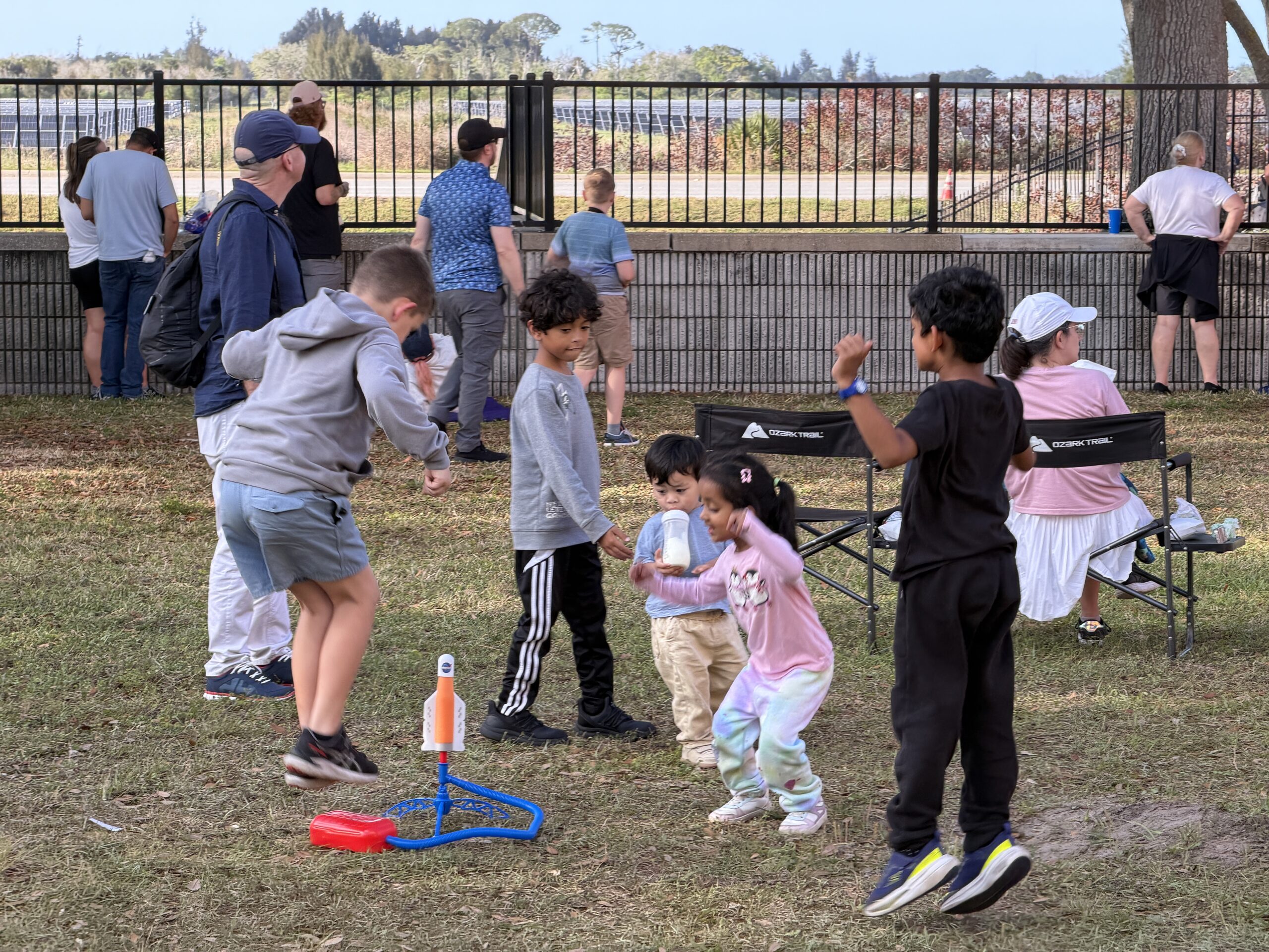
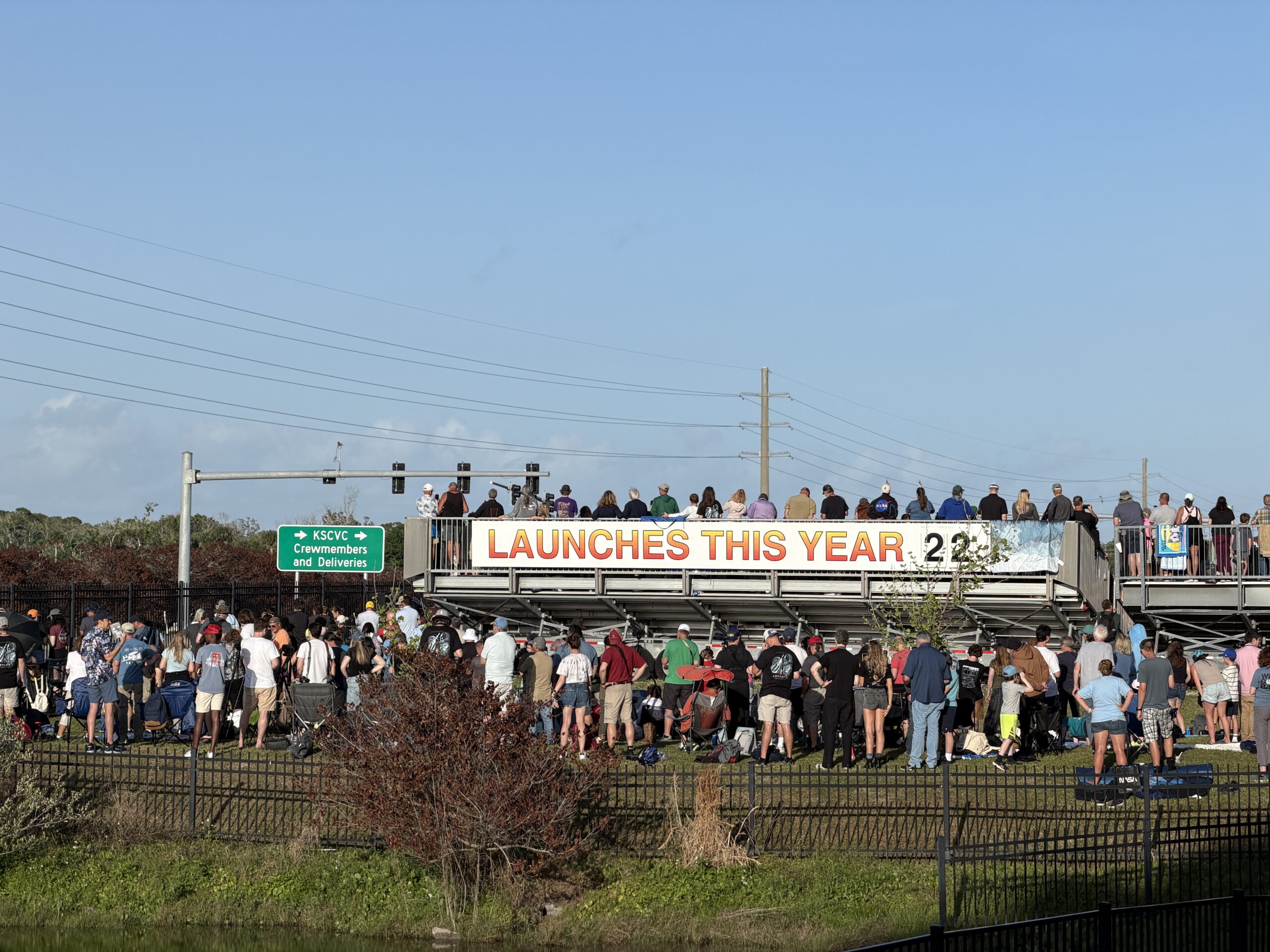
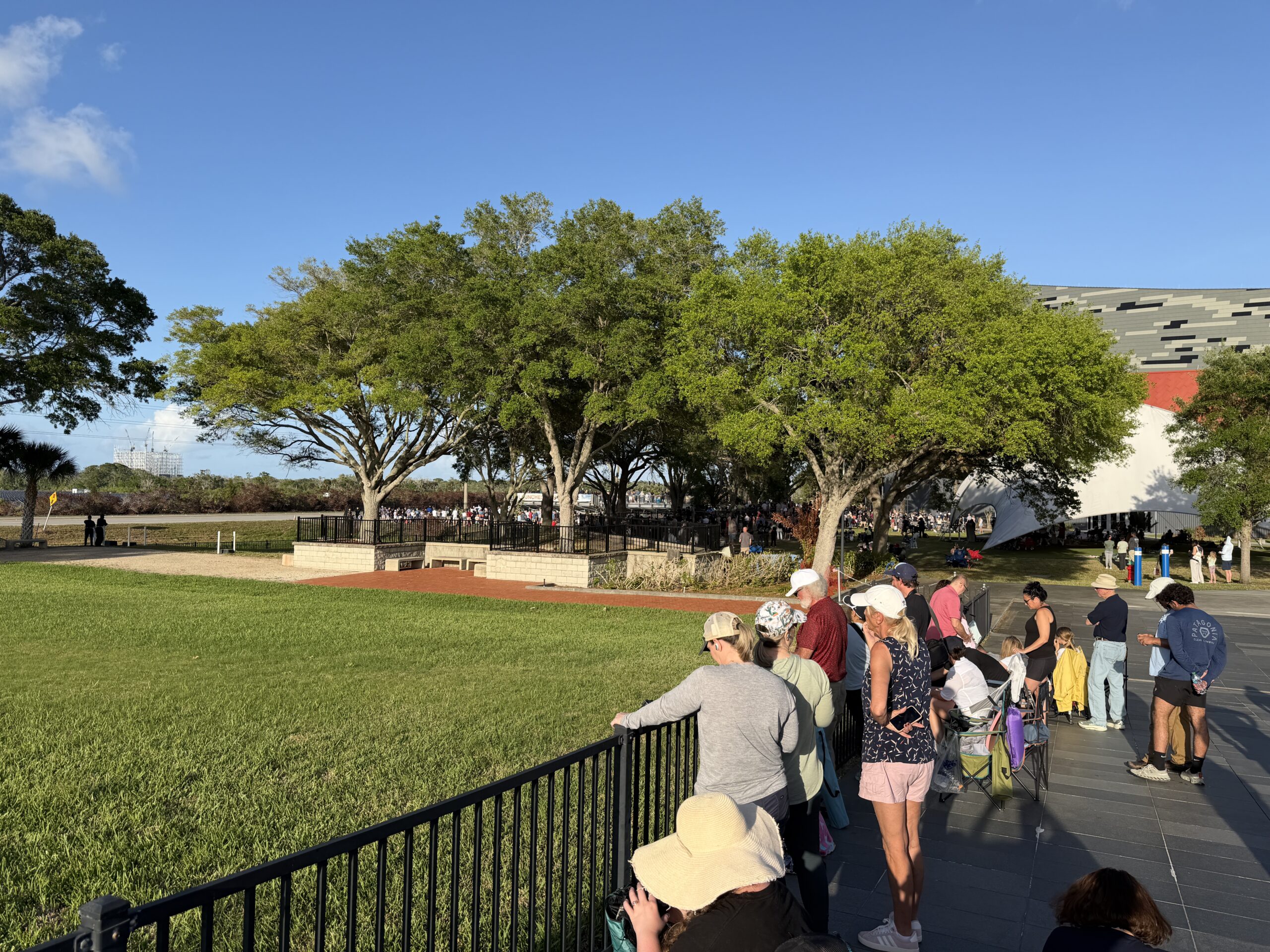
The bleachers and prime viewing areas near big-screen TVs were packed, but nearby areas almost as good weren’t crowded:
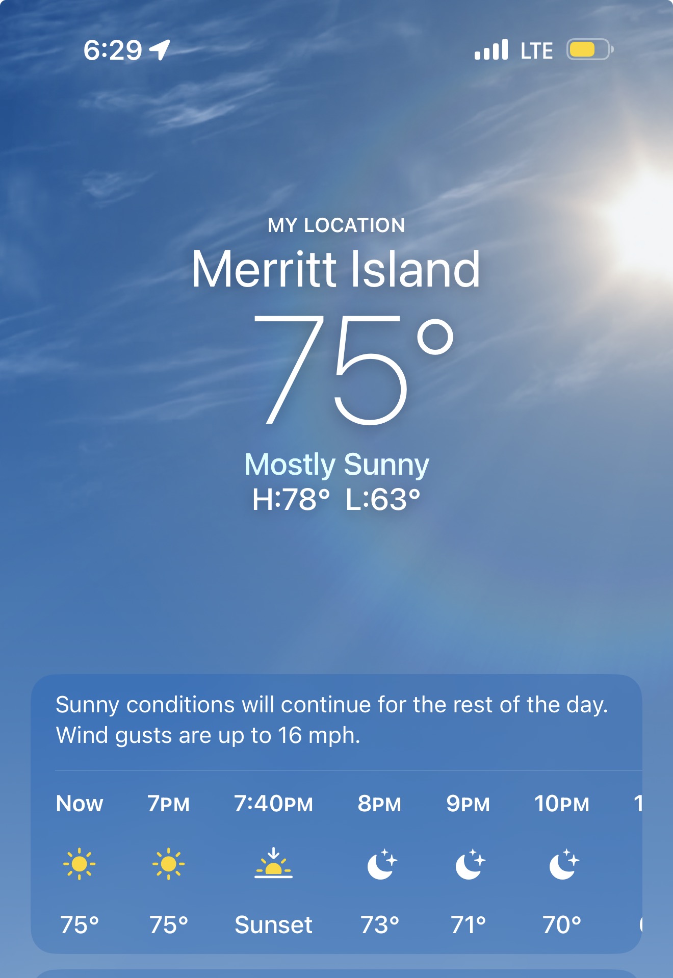
The weather was perfect:
The launch itself was loud, but not to the point that it would have been nice to have earplugs.
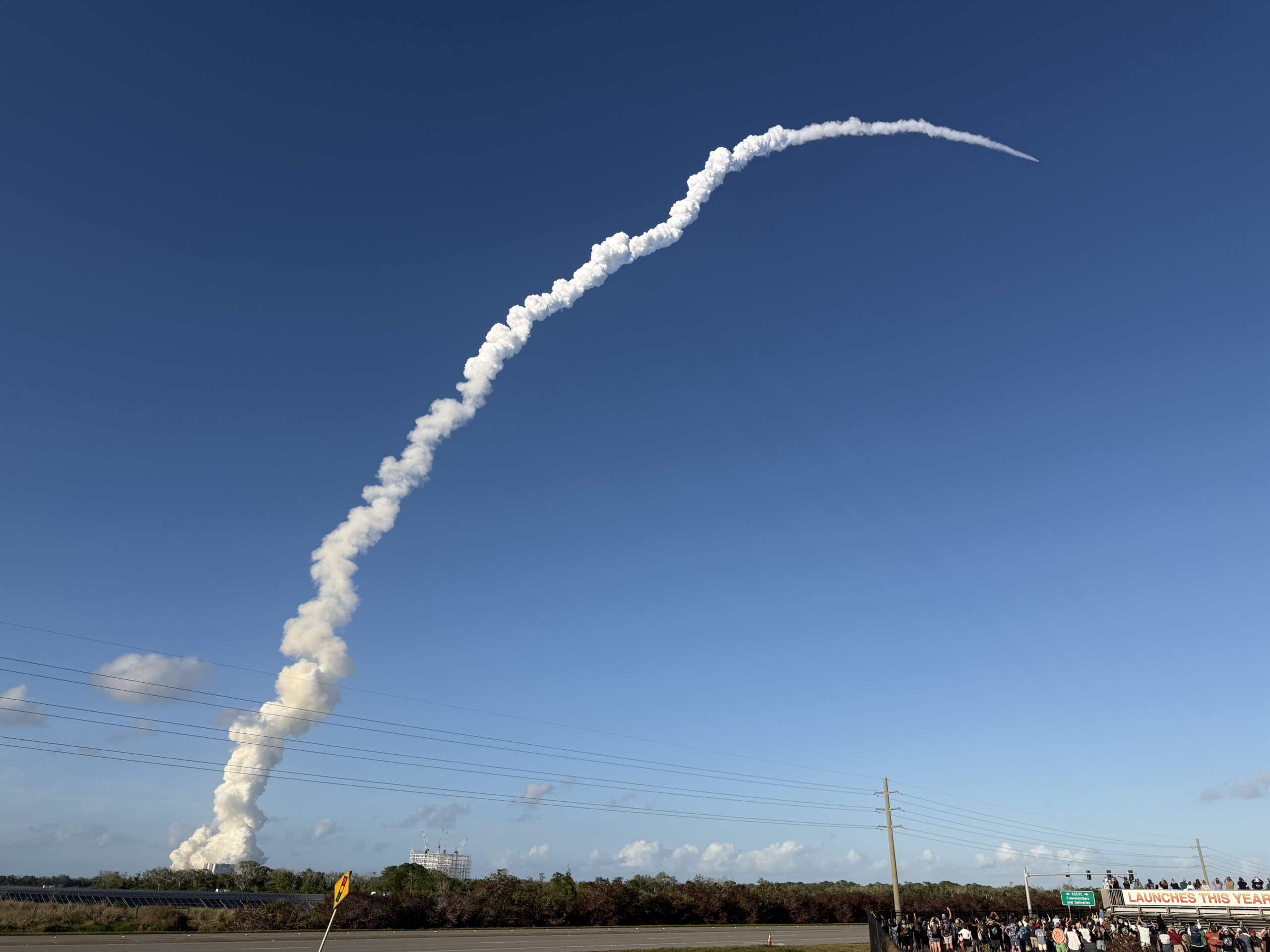
We had binoculars, but it was uncomfortable to look at the vehicle with them because the rocket exhaust is so bright. I didn’t make a video because I believe in “f/8 and be there” (i.e., the cameras set up by NASA and affiliates close to the pad are going to “be there” and do a much better job).
The trip back to the airport took about 45 minutes through some traffic.
I flew the Cirrus back to her Stuart, Florida home, about 35 minutes under a full moon. Orlando Approach refused to provide “flight following” (formerly there was a big push to call this “VFR Advisories”, but that seems to have died along with “Notice to Air Missions” as a replacement for “Notice to Airmen”) due to “staffing”. Florida is bursting at the seams!
Was it worth a whole day for a 4-minute launch experience? Sure. I was glad that I was there for a Florida community experience. Although we weren’t there for long, we chatted with people who’d been there for hours in folding chairs and who were extremely passionate about space flight, e.g., a family from Melbourne, Florida whose kids are techies in Atlanta and have come home for every Artemis attempt. It would have been a lot less traffic and more fun to enter the KSC at around noon and spend the day waiting with the crowd. If you just want to experience the sound and fury of a rocket launch, though, it would be just as good to get a “feel the heat” ticket to watch a SpaceX Falcon 9 launch (much less likely to scrub) from the Saturn V building. It’s a smaller rocket, but being only half the distance away means the visceral effect is as large or larger.
Let’s hope the Artemis mission is a success. If it is, though, we’ll be forced to conclude that it is easier to send an Astronaut of Color, an Astronaut of Femaleness, and an Astronaut of Canadianness (another victimhood category?) to the moon than it is to deport Kilmar Abrego Garcia, Mahmoud Khalil, or most other migrants.
(Given SpaceX Starship, what is the point of the SLS and Artemis, you might ask? A friend at NASA Goddard: “It’s a jobs program so that NASA didn’t have to fire the people who worked on the Shuttle.” In his view, all of the SLS/Artemis goals could be accomplished at a much lower cost by SpaceX. Keep in mind that Science NASA is jammed with haters of the manned space program!)
Related:
- Artemis launch subjected to abortion care to “protect NASA employees”
- Will NASA need to choose a new crew for Artemis in light of the recent Supreme Court decision banning race discrimination?